
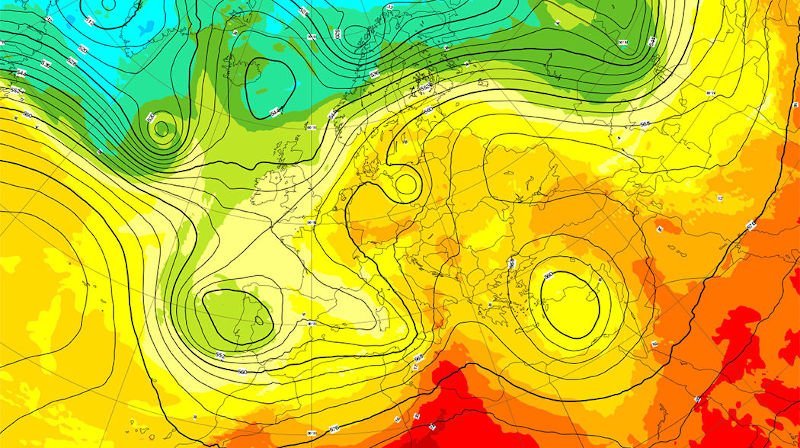
In this article, I’ll try to answer the question that probably brought you here: which marine weather forecast is the most reliable?
To do that, we first need to understand how a weather forecast is produced, and look at its main tool: the weather model.
Join the webinar “Understanding Weather Models” led by a professional meteorologist.
What is a weather model?
A weather model is a computer program that tries to forecast how the atmosphere will behave by applying physical and mathematical rules to known weather parameters. These parameters include — among others — satellite data, weather station reports, and observations.
Then, algorithms defined by meteorological engineers generate forecast data on a grid of varying resolution. This grid can range from about 100 km (global or general models) down to 1 km (regional, high-resolution or fine-mesh models).
The data produced by these model runs are the basis of all our weather forecasts.
If you’d like to dig deeper, I recommend the excellent article from the Encyclopédie de l’Environnement on weather forecast models.
The main models
Most major meteorological organizations around the world run their own models. Here’s a focus on the 5 main ones — the ones you see every day in the weather forecasts you use, often without realizing it.
GFS
Let me introduce GFS (Global Forecast System), the American heavyweight. It’s a classic global model, widely used at its 22 km grid, and you’ll find it on most weather websites.
Pros: wherever you are in the world, GFS can give you a free long-range weather forecast.
Cons: it’s a relatively basic model, and its results can be disappointing locally.
ECMWF
In the big-league category, we have ECMWF (European Centre for Medium-Range Weather Forecasts). This well-known and highly regarded European model, with its 9 km grid, is an excellent working tool for centers that have (or give themselves) the means to use it.
Pros: probably one of the best global models thanks to the quality and reliability of its forecasts.
Cons: quality often comes at a price — this is a paid model, so it’s not widely available online.
ICON
ICON (Icosahedral Nonhydrostatic) is a high-quality German model, used both at 22 km and at 5 km resolution — a true all-purpose weather model.
Pros: provides a solid, high-quality alternative for Europe.
Cons: honestly… none that really stand out!
AROME
The French developed the very high-resolution model AROME (Application of Research to Operations at Mesoscale) to meet local needs. Its 1 km grid makes it a remarkably precise tool.
Pros: extremely accurate locally over the short term.
Cons: its use is mostly limited to those specific strengths.
NEMS
And to finish, here’s a slightly different one: the Swiss model NEMS (NOAA Environment Modeling System). It’s actually built from a combination of classic models on top of which artificial intelligence (AI) has been applied. It’s a safe bet that deep learning will be used more and more in weather forecasting in the future.
Pros: a different approach that’s often relevant.
Cons: much more accurate in the mountains than at sea.
Of course, there are many other well-known models such as ARPEGE, WRF, CFS, and more. I’ve chosen here to focus only on the ones I think are essential to know inside out!
Which weather model for which use?
To choose which model to use, I suggest looking at the distance and duration of your planned passage.
As you’ve probably understood by now:
- a fine (high-resolution) grid is best for local / coastal sailing,
- a coarser (global) grid is better for longer offshore passages.
- Coastal sailing and/or up to 24–48h: use a high-resolution model
- Offshore sailing and/or several days: use a global model
Where can you find forecasts based on these models?
The most direct way to get data from these models is via the well-known GRIB files. But if you don’t need to build a full routing, these raw files probably won’t be very useful to you.
For simple viewing, you can use the weather maps available on the site — I update them regularly.
And for deeper analysis, the Czech company behind Windity offers a tool that lets you view all the models mentioned above: Windy. And it’s free! I’m considering writing a dedicated article to walk you through all the possibilities of this little gem 😉
Model comparison in pictures
Because five images are worth more than a thousand words, here’s a comparison that makes it easy to see what sets each model apart.
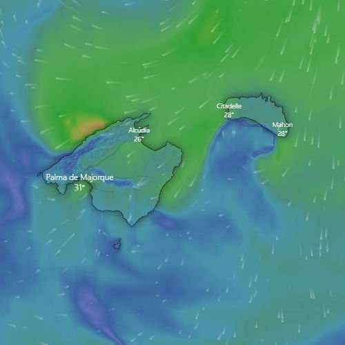
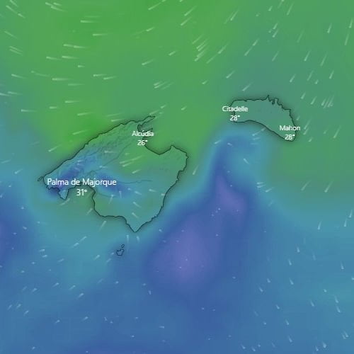
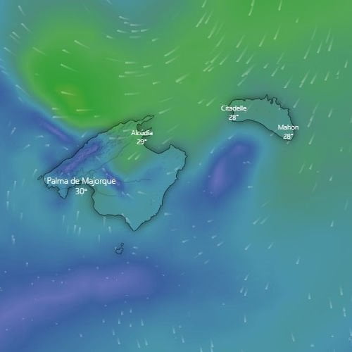
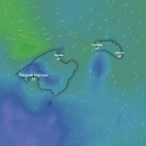
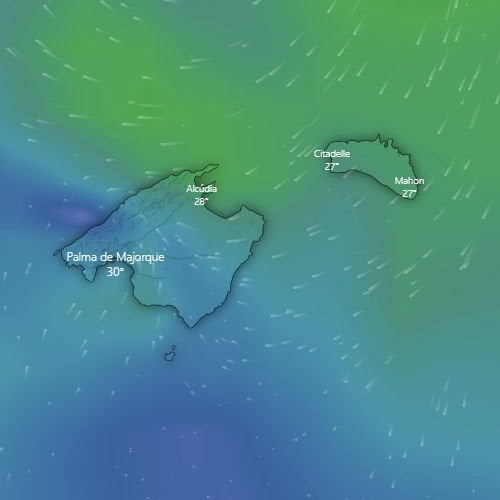
In this example, the coarser the grid, the less precisely the wind shadow is shown. So what’s the point of large-scale models, you may ask? Well, they let you work on medium- and long-range forecasts over wider areas — and therefore over longer distances.
In conclusion, all models complement one another — it’s important to know the strengths and weaknesses of each.
Any questions? Let’s discuss in the comments 👇